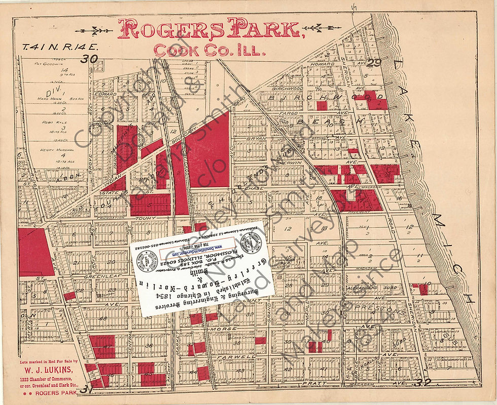
We are offering a COLOR COPY of an antique advertisement map of the East Rogers Park; it shows 2 square miles area from Pratt Ave. to beyond Indian Boundary Road, and from Lake Michigan Shore to beyond Ridge Ave.
It is a beautiful colored plat map, prepared by one of our predecessors.
It shows some Lots highlighted in red with a note "Lots marked in Red For Sale by W.J. Lukins, 1223 Chamber of Commerce, or cor. Greenleaf and Clark Str., Rogers Park"
As all other our maps & plats, this one has some of the surveyor's indexing markings & notes from various surveying projects, completed in the area.
To properly date this map we referred to our extensive archive. The size is appr. 10.5" x 12.75".
#RogersPark #EastRogersPark #PrattAvenue #IndianBoundaryLine #RidgeAvenue #LakeMichigan #Chicagohistory #Chicagomap #antiquemap #Chicagoancestry #Chicagoneighborhood #oneofakind #neverbeenseen #amazingcraftsmanship #uniquemap #historicalmap
#EastRogersParkmap #EastRogersParkhistory #Rarefind
top of page
$80.00Price
Excluding Sales Tax
bottom of page
